Severe Tornado Outbreak Threat Grows Across Great Plains and Great Lakes
Meteorologists are sounding alarms as a significant severe weather pattern develops across the Great Plains, stretching toward the Great Lakes, with heightened tornado activity expected in the final ten days of May and extending into June. The European Ensemble Model, a respected long-range forecasting tool, has issued striking signals pointing to a major tornado outbreak erupting soon—raising the possibility of a season rivaling the infamous 2004 tornado season.
The 2004 season was historic for producing numerous violent, long-track tornadoes across multiple states over several weeks. Forecasters now warn that similar explosive conditions may unfold soon, putting millions at risk from the central US plains through the Mississippi Valley and into the Great Lakes region.
Powerful Atmospheric Setup Fuels Tornado Risk
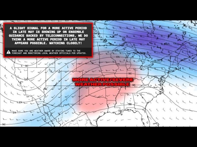
The driving force behind this looming severe weather surge is a classic trough-ridge pattern over the United States. This atmospheric configuration generates critical ingredients for extreme tornado formation, such as strong wind shear, abundant moisture, and atmospheric instability. The Euro Ensemble 500mb wind analysis from May 7, 2026, clearly reveals this pattern emerging, forecasting a deep trough over the plains paired with a ridge stretching eastward — an ideal setup for widespread severe storms.
This configuration supports the development of powerful supercells capable of producing numerous, potentially long-lasting tornadoes. The severe weather zone is expected to span from the southern and central plains, including portions of Kansas, Oklahoma, and Nebraska, northeast into Illinois, Indiana, and up to Michigan and Ohio in the Great Lakes region.
Consistent Signals Demand Vigilance from Residents and Officials
Meteorologists emphasize that while ensemble model forecasts carry some uncertainty, the consistency of multiple runs underscores the seriousness of the threat. Officials urge residents to update safety plans, verify emergency alert systems, and stay tuned to local weather forecasts.
“Atmospheric patterns currently developing mirror those seen in some of the most devastating tornado seasons in US history,” said a senior meteorologist monitoring the Euro Ensemble model. “All communities in the threat corridor need to prepare immediately.”
The SaludaStandard-Sentinel.com will continue providing in-depth coverage and critical storm updates as this severe weather threat unfolds.
Why Kentuckians Should Watch This Develop
While this forecast focuses on the Great Plains through Great Lakes, Kentuckians should remain alert given potential ripples of severe weather and late season tornado dynamics can extend into the Mississippi Valley corridor. Kentucky’s location close to this emerging threat means residents should review their severe weather readiness ahead of the potentially historic late May outbreak period.
What’s Next? Monitoring and Preparation for Potentially Historic Tornado Outbreak
Over the coming days, meteorologists will monitor updates to the Euro Ensemble and other models closely. Severe weather conditions are expected to ramp up between now and early June, requiring immediate attention from emergency services and the public alike.
To stay informed, residents across impacted states and beyond should subscribe to local weather alerts and prepare for the possibility of long-track tornadoes and widespread destructive storms that could rival one of the most violent tornado seasons in recent US history.
Key Takeaways for Immediate Action:
- Expect dangerous tornado outbreaks from the Great Plains to Great Lakes late May into June
- Prepare and review severe weather safety plans now
- Stay informed through official weather channels and local alerts
- Recognize that this pattern could rival the sustained tornado activity seen in 2004
This developing severe weather threat stands as a critical reminder of nature’s power and the urgency of preparedness as peak tornado season arrives in the central US.