Riverside County Shuts Five Popular Hiking Areas Amid Escalating Wildfire Risks
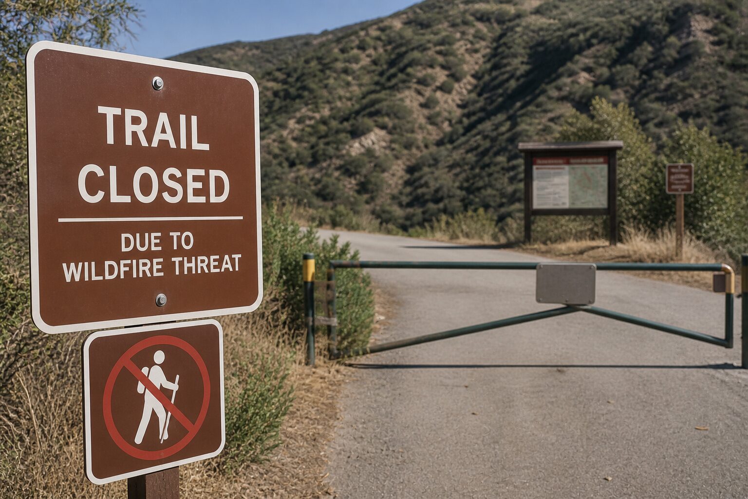
Riverside County, CA – The Riverside County Fire Department has launched immediate closures of five high-risk hiking areas starting Friday, May 1, citing dire wildfire threats fueled by extreme vegetation growth and dry weather conditions. This urgent action aims to protect residents and natural lands as the county braces for one of its potentially most destructive fire seasons.
The closures include:
- Eagle Canyon/Tin Mine (east of Corona)
- Steel Peak (north of Lake Elsinore)
- Bautista Canyon (southeast of Hemet)
- North Mountain (south of Banning, north of San Jacinto)
- Ramona Bowl (south of Hemet)
These closures will remain in place until County Fire Chief Robert Fish determines that weather and fuel conditions have improved enough to safely reopen the public spaces. The closures are part of a broader strategy approved unanimously by the Riverside County Board of Supervisors on April 28, intending to minimize ignition risk and protect life and property in the face of growing wildfire danger.
Zero Tolerance for Violators with Fines in Place
Under Riverside County Ordinance 787.9, access to these identified hazardous fire zones is restricted, and public open burning is suspended to mitigate fire hazards. Residents and private landowners within these closed areas retain access rights to their properties but are warned that any unauthorized trespassers face a minimum $100 fine for first-time violations.
Riverside County authorities underscore the importance of public cooperation, especially as these conditions pose a severe threat not only from wildfires but also from other emergencies like earthquakes and floods.
Fire Season Declared Early: May 1, 2026
Chief Fish will officially open the wildfire season on May 1, 2026, signaling a period of heightened alert for residents and emergency responders alike. The call to action includes key preparation steps such as maintaining a minimum of 100 feet of Defensible Space around homes and buildings and staying ready to evacuate at a moment’s notice.
“The extreme growth of vegetation combined with dry conditions significantly increases our wildfire risk,” Chief Fish said in his recommendation to the Board. “These proactive closures save lives and lands.”
Stay Alert and Informed with County Emergency Systems
The Riverside County Fire Department urges residents to stay vigilant by signing up for the county’s emergency notification system, Alert RivCo. The platform provides real-time updates on fire threats and evacuation orders, critical for safe and effective emergency response.
Residents can register and access resources at www.rivcoready.org/alert-rivco and learn more about wildfire readiness at rivcoready.org.
Maps of the closed hiking areas are accessible at https://tinyurl.com/hikingclosures. For further assistance, contact the Public Affairs and Community Education Bureau at 951-940-6985.
Possible Future Closures
Officials warn that depending on upcoming fuel moisture levels, weather patterns, and fire threats, additional closures may be enforced to protect the public and natural resources.
The escalating wildfire risk in Riverside County reflects a growing nationwide challenge as warmer temperatures and drought conditions spread. Kentucky readers and U.S. residents should note that wildfire safety preparations—like clearing defensible space and knowing evacuation routes—are increasingly critical across all wildfire-prone regions, including the Bluegrass State’s own vulnerable forest and rural areas.
Key Takeaway: The early and decisive closure of high-risk hiking zones in Riverside County highlights the accelerating wildfire danger across the nation in 2026—underscoring the urgent need for preparedness and community cooperation.