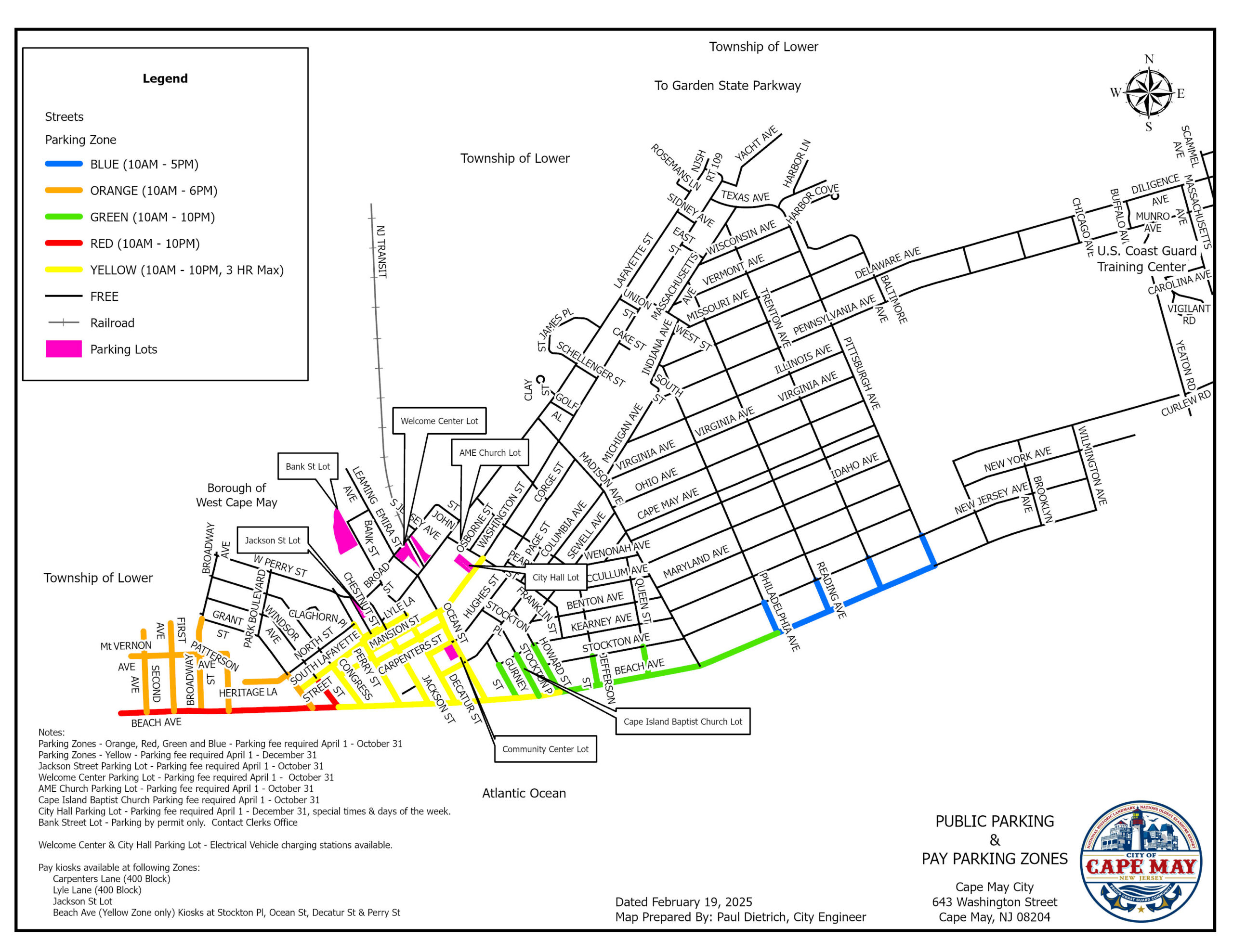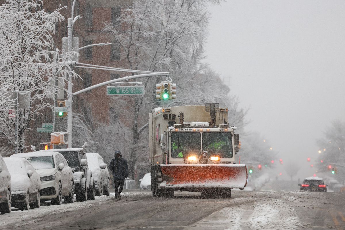
UPDATE: A staggering 72 million Americans are currently facing winter weather disruptions as powerful winds and snowstorms threaten to upend holiday travel plans. A massive weather system is sweeping eastward from the High Plains and Rocky Mountains to the Northeast, with gusts reaching up to 60 mph in certain areas.
Wind alerts are in effect across multiple states, with the most intense impacts expected in Appalachia, New England, and coastal Maine. While rain and wind will continue to batter communities from Washington, D.C. to Boston into the evening, the most significant travel disruptions are anticipated on the West Coast, particularly in California, during the upcoming Christmas week.
California, which recently escaped the severe storms that devastated the Northwest, is bracing for a dramatic change as a series of storms are set to unleash heavy downpours from this weekend through Christmas. This could trigger urban flooding, small-stream overflows, and potential river flooding, especially in lower and mid-level areas. Residents can expect inches of rainfall, with the highest totals on west- and southwest-facing mountain slopes.
Airports across the Northeast may also experience significant delays as lake-effect snow blankets the region today. AccuWeather Senior Meteorologist Adam Douty warns that a larger clipper storm will impact parts of the Upper Midwest and Northeast from Monday to Tuesday, with Tuesday likely to be the most challenging day for weather-related travel disruptions, particularly from northern Pennsylvania’s Pocono Mountains to central and northern New England.
In the Sierra Nevada and parts of the Cascades, travelers should prepare for multiple feet of snow at higher elevations, with snow levels dipping to pass levels at times, according to Bernie Rayno, Chief On-Air Meteorologist at AccuWeather. Although the weekend forecast appears calmer aside from lingering winds and snow in the Great Lakes area, the potential for severe weather looms.
Meanwhile, states avoiding the wintry blast are set for one of the warmest Christmases on record, with temperatures soaring into the 70s and 80s Fahrenheit across at least a dozen states, according to AccuWeather. Record highs are expected from Texas to Missouri and Georgia on both Christmas Eve and Christmas Day.
New Yorkers hoping for a snowy Christmas may be disappointed, as the holiday is forecasted to be dry and comfortable with temperatures in the mid-40s. There is, however, a chance for light snowfall early this week. John Feerick, senior meteorologist at AccuWeather, noted, “Even if we were to get a small accumulation out of that, it would melt by the time we got to Christmas.”
Historically, a white Christmas in New York City is rare. The last significant accumulation on Christmas Day occurred in 2002, when 5 inches of snow fell in Central Park. In fact, only six times in the last 156 years has New York City recorded over an inch of snowfall on Christmas Day.
As millions prepare for holiday travel, stay tuned for updates on this evolving winter weather situation.